


Tsunami Impacts
The other thing to see on the Tohoku Coast

As I mentioned in the previous post1, we visited the area that was devastated by the 2011 earthquake and tsunami. We didn’t specifically go to look at the devastation or how things have recovered but it’s an interesting topic and seems suitable for “less known Japan”
Signs
In terms of general life, there is no trace of the devastation today. Things have been rebuilt, there’s lots of new concrete and if you didn’t pay attention to the signs marking the extent of the inundation and the occasional surviving building left as a monument to the destruction, you would have no idea.
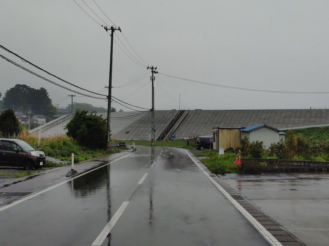
Yes it is a bit odd to have fishing ports on one side of enormous sea walls with nothing much on the land side except roads and waste land, but Japan does have odd abandoned but cleaned up areas so it’s not completely unprecedented.
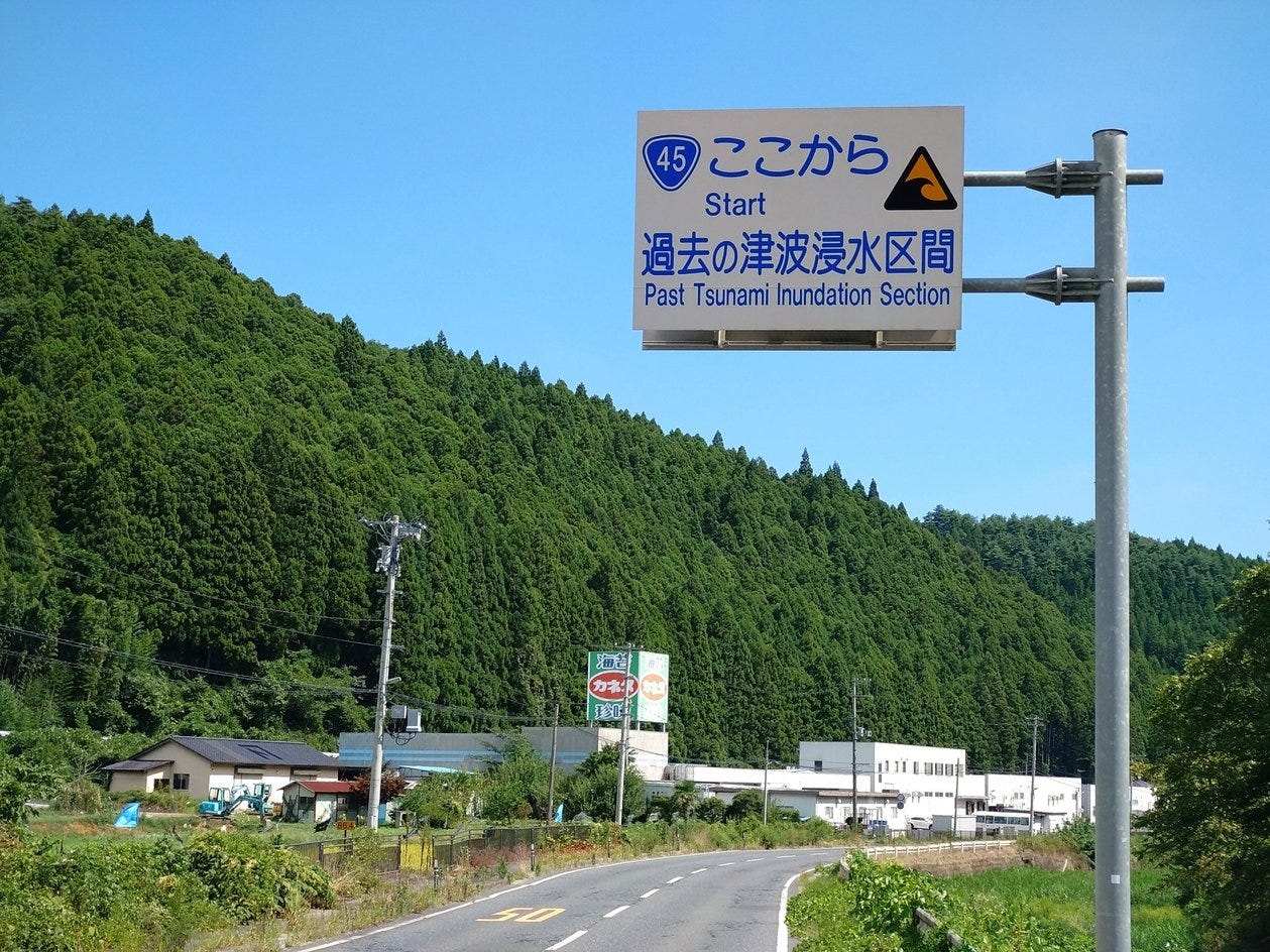
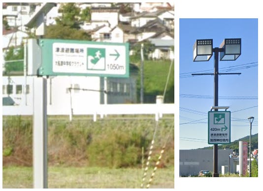
But the signs do drive home just how big the event was. You drive down a road with no obvious sign of the sea and come across a sign like the one above (here, about 2km from the coast) noting that the tsunami waters reached that far.
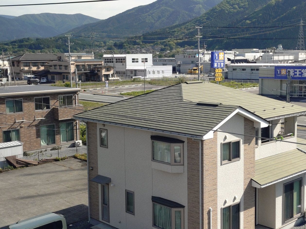
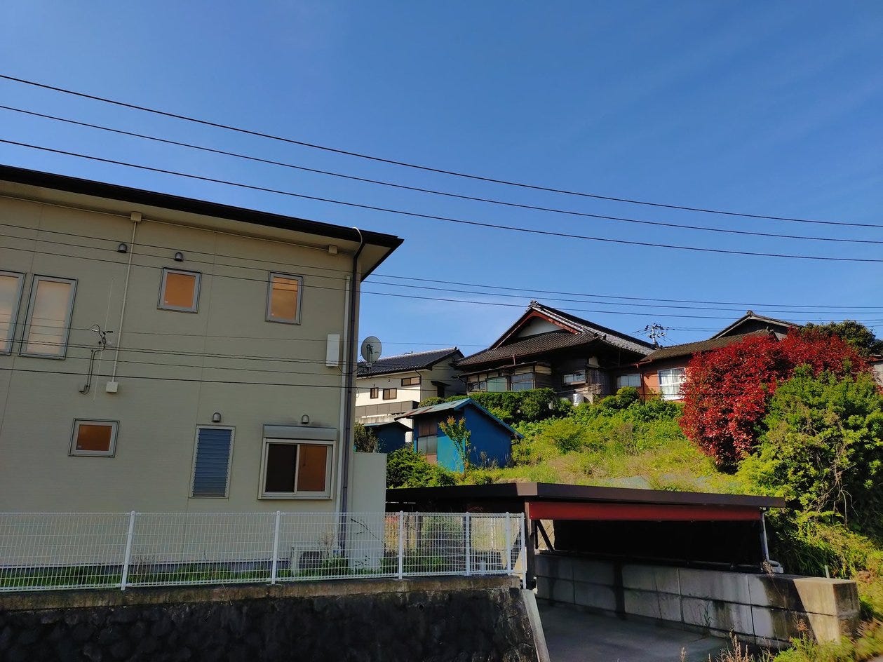
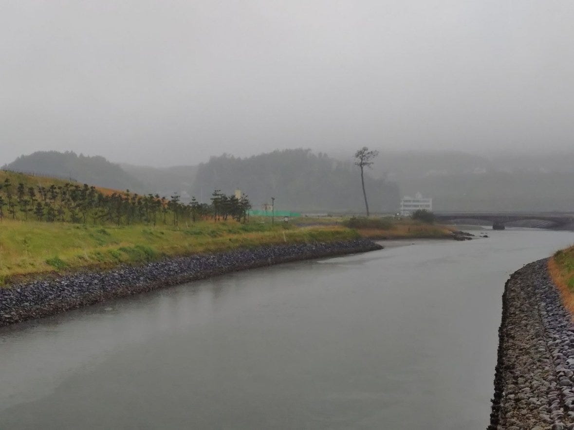
Or you look out of your hotel window2 and observe that all the buildings on the flat area are new, while the ones up above on the hillside are mixed old and new
Or the way there are large signs telling you the closest high ground all over the place
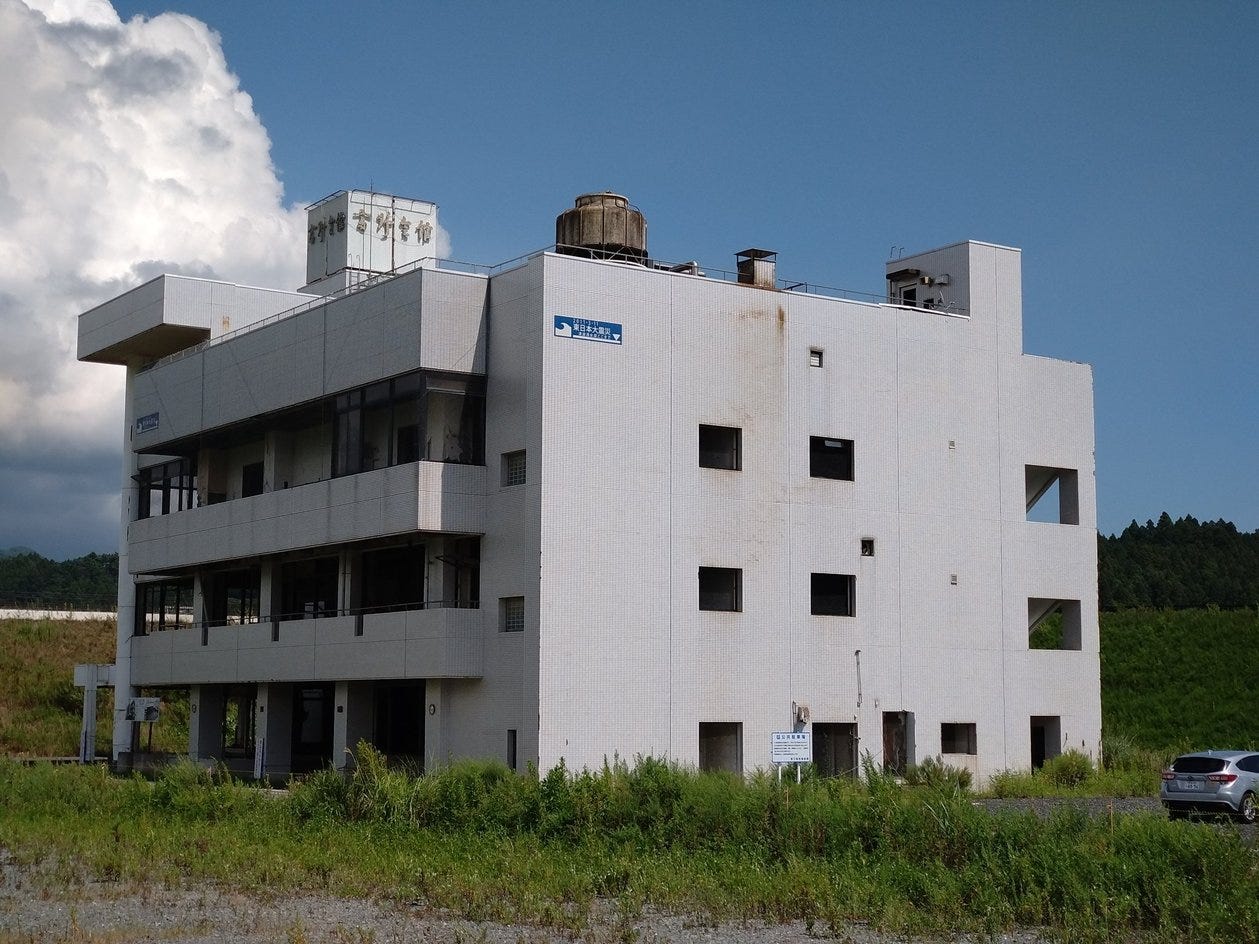
There are small reminders about the tsunami everywhere. But there are also larger ones, such as the various buildings left in their smashed state to illustrate just how huge the event was.
There are also numerous specific memorials and at least one museum, which we visited
Iwate Tsunami Memorial Museum
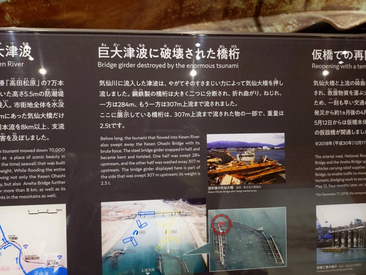
Thanks to the weather we decided to spend an afternoon indoors and the Iwate Tsunami Memorial Museum in Rikuzen Takata was suitably close so we went there. It’s fairly small, free to enter and well worth visiting and has most of its exhibits described bilingually
There are various sections to the museum. One of the things I found interesting, but failed to get a decent picture of, was a bore of earth which showed numerous tsunami events over the last 5000 or so years. Once the tell tale signs of tsunami - shells in the earth - were pointed out it was easy to see that the coast has been hit repeatedly by tsunamis.
One of the other things that the museum pointed out in various places is that the size of the tsunami is estimated with numbers like “more than X” because the instruments that gathered the data were destroyed by it and X was the last measurement they reported.
Since the this is a disaster in the modern age there is also a video gallery that plays videos of the tsunami happening to remind you of just how much destruction there was.
However the museum is much more than disaster porn. There’s a significant section on lessons learned and how to survive future tsunamis. Some of those lessons were probably used by the people in Noto for the 2024 quake there. One of the lessons I took from that is that if you fear a tsunami after an earthquake then you should seek high ground immediately and then wait for at least an hour before going back. There were tragic stories of people who decided that either the tsunami would be smaller or was not happening and either stayed put or actually went back down to try and get more supplies etc. and were caught by the wave when it hit.
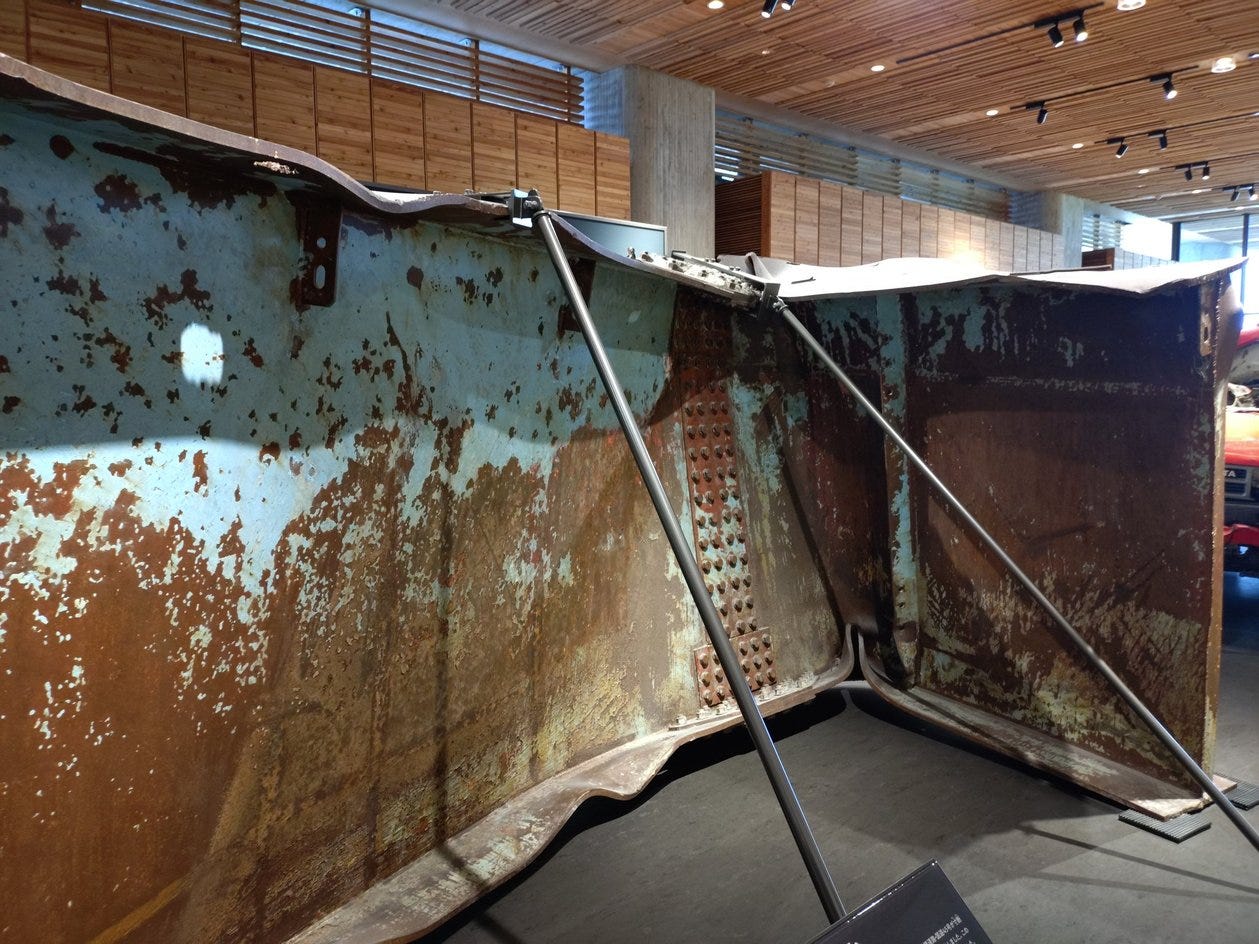
Finally the museum has an outdoor memorial section which includes a couple of surviving buildings. One of the buildings, the Tapic 45, was the refuge for three? people who ended up on top of the building and had to watch as everything around them washed away. There’s also the “miracle” lone pine, which did not get washed away or die in the tsunami unlike all it’s neighbors in the tsunami absorption zone
It turns out that a lot of smaller tsunamis can be mitigated by a grove of trees that will absorb much of the waves - something that I had no idea about - and so many of the towns on the Sanriku coast had a plantation of trees designed to do so. The miracle pine is the sole survivor of the tsunami which was much, much larger than they could protect against.
Earthquake Effects
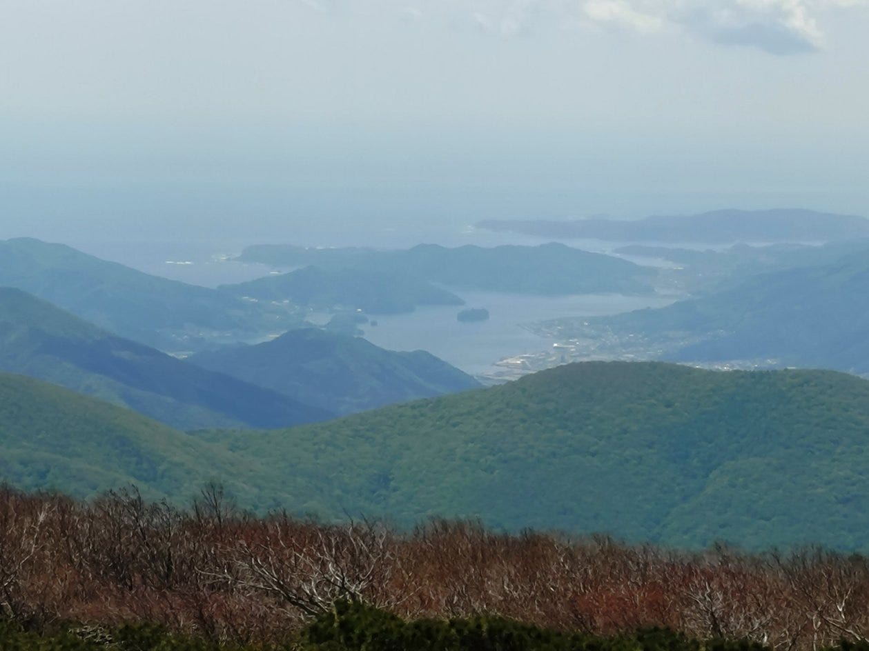
A final note. Apparently, the mountain overlooking Ofunato - Goyozan 五葉山 - was affected by the earthquake if not the tsunami. The place where they mark the summit of the mountain is not, in fact, the highest point these days. The actual highest point now is the Hinode rock (日の出岩) at 1351m, the official summit is now 1340m. I’m not clear if the old summit subsided, the Hinode rock grew (or both)
Goishi Kaigan (碁石海岸)

The Goishi Kaigan is part of a peninsular between Ofunato and Rikusentakata in Iwate. If you were in Japan, or paid any attention to Japan, when the Great Tohoku Earthquake and Tsunami happened in 2011 you’ll recognize those names as those were two of the ports washed away by the tsunami. In fact I’m writing this in a ryokan in Ofunato
Kikusuikan Ryokan ( 旅館 菊水館 ) - strongly recommended for the food
It's fascinating to see the traces of the tsunami today. I like "lesser known places" -- obviously.