


Goishi Kaigan (碁石海岸)
Part of the rugged, spectacular Iwate coast

The Goishi Kaigan is part of a peninsular between Ofunato and Rikusentakata in Iwate. If you were in Japan, or paid any attention to Japan, when the Great Tohoku Earthquake and Tsunami happened in 2011 you’ll recognize those names as those were two of the ports washed away by the tsunami. In fact I’m writing this in a ryokan in Ofunato1 that is about a decade or so old and built after the clean up, as is every building around it.
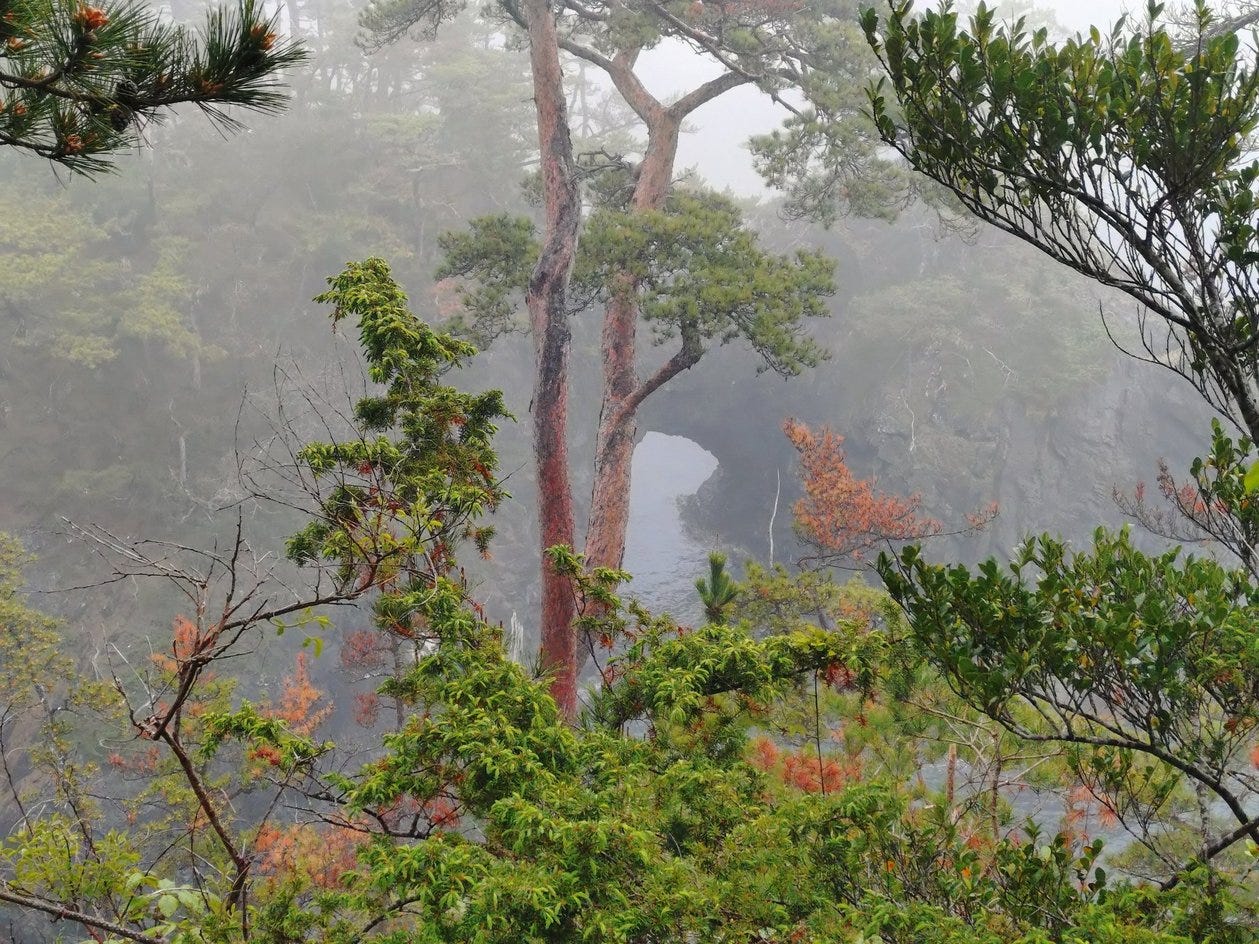
Of course the Goishi coast was also affected by the tsunami, but because it is nature and much of it is cliffs and rocky islands, you can’t tell. Unfortunately, what you can tell though, is that the spectacular pine trees that are a part of the ambiance are going to go away fairly soon. That’s because the pine (borer?) beetle has spread to Iwate and is now spreading through the trees on the peninsular. In a decade or so I expect most of the pine trees we walked past are going to be dead. There are sugi and various other trees so it won’t be a barren wasteland of dead trunks, but it’s going to look very different. If you want the classic pine tree look you need to visit ASAP
There is a clearly marked path along the coast and you can do as we did and make a loop going over the other side or you can just go back. In good weather you can also take a boat ride along the coast but I’m not sure how you book it (I recommend asking at the visitor center)
Origin of the name
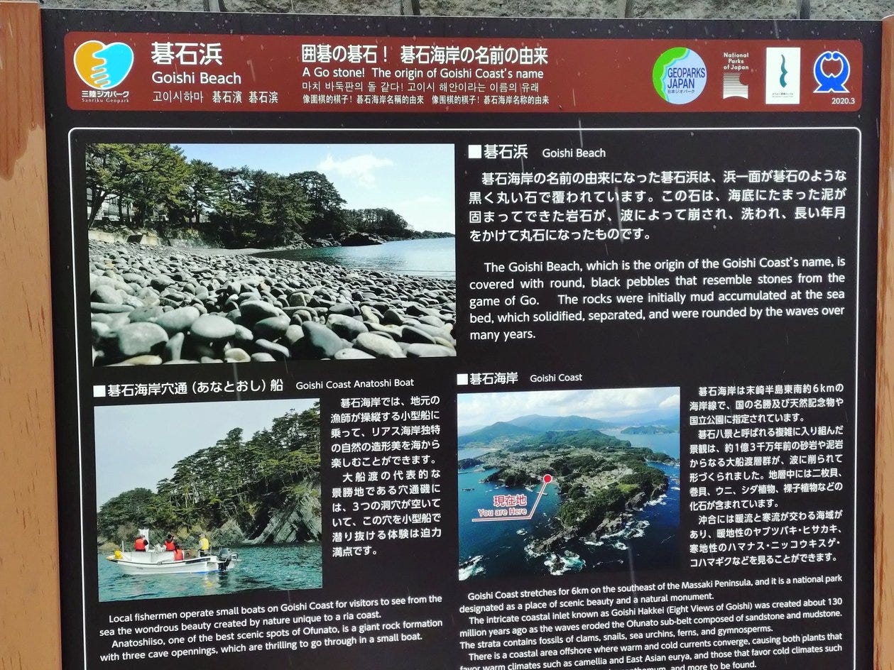
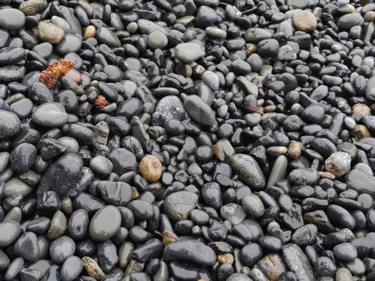
Goishi means Go stone(s), where Go is the game of that name. And it is, see picture below, well named. Lots of round black stones that you could use to play Go.
Damp Weather is OK
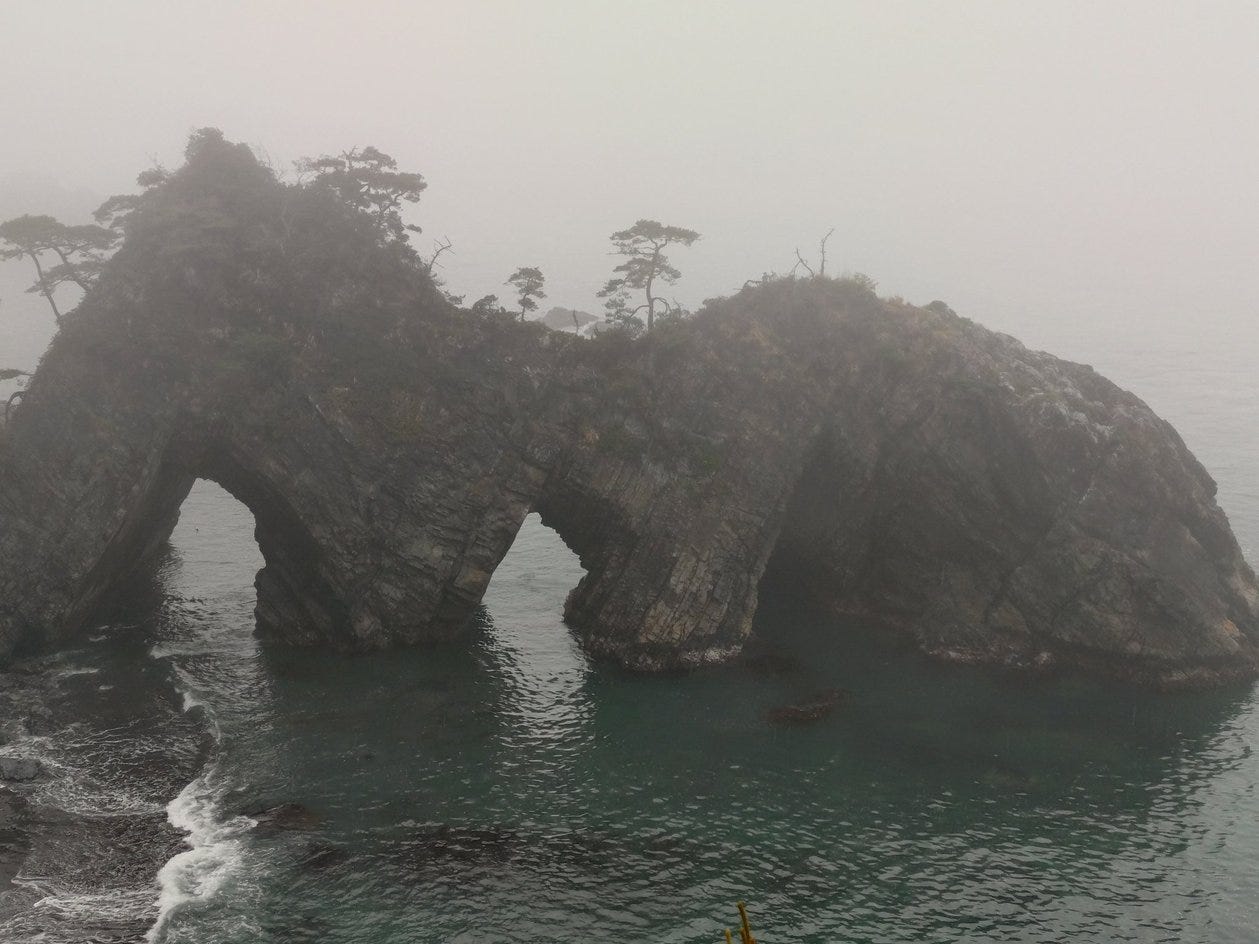
The weather when we walked was a misty drizzly day to begin that gradually got worse. The heavier rain was not so good, but the light mist for the first part gave some absolutely amazing views that the photos cannot properly reproduce. It felt like being on the set of a spooky movie or an early Dr Who. The cries of the seagulls helped spookify things. I’m sure that it’s also beautiful in better weather, but it was kind of special in the drizzle.
The Goishi cape set the scene for the day, seagull cries, waves breaking on rocks and mist that meant that distant objects were faint when not totally invisible
As you walk north you see various natural rock bridges.
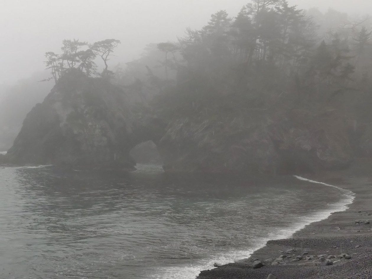
Ohama “beach” is where the round stones I posted above were taken. It also has this rock bridge above.
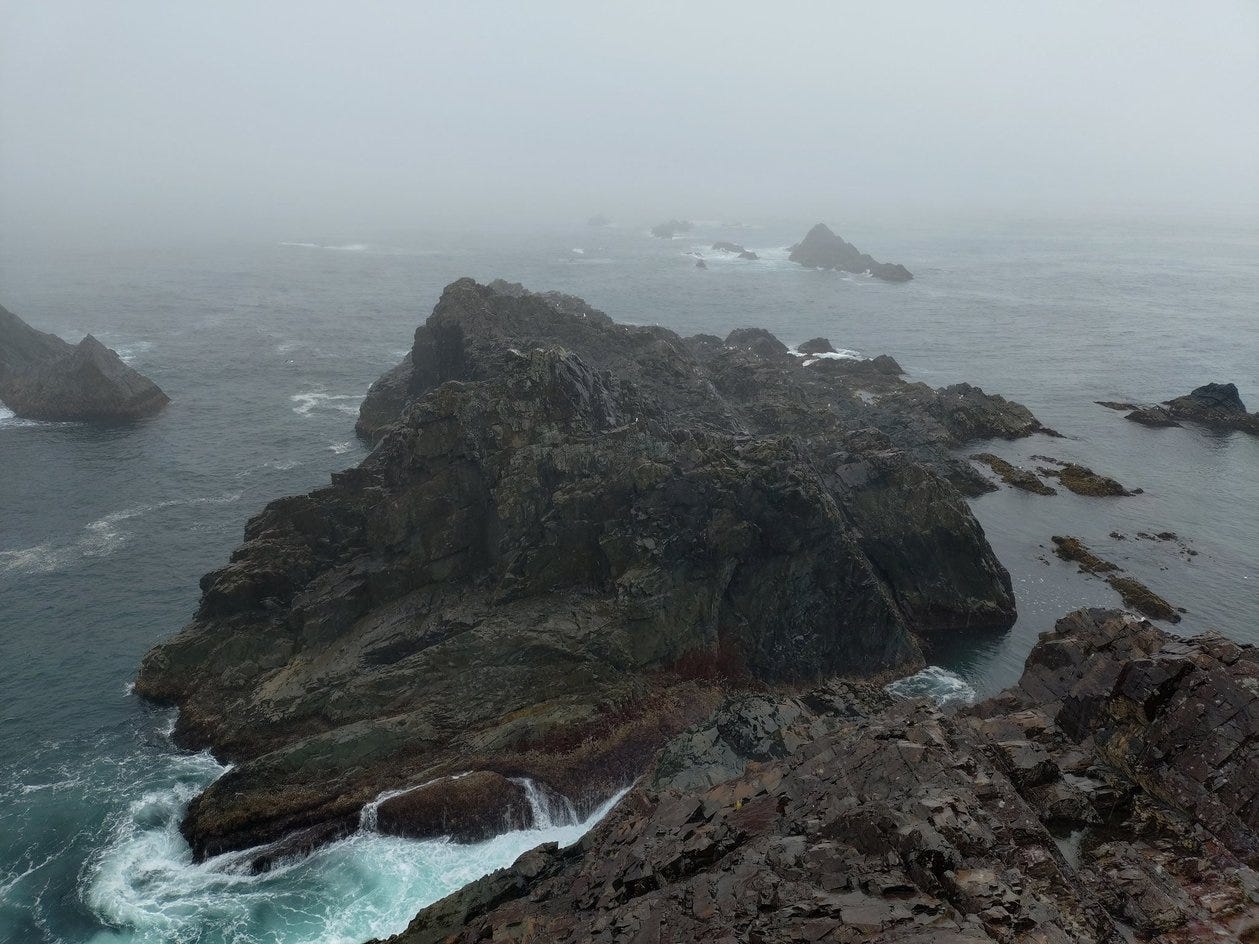
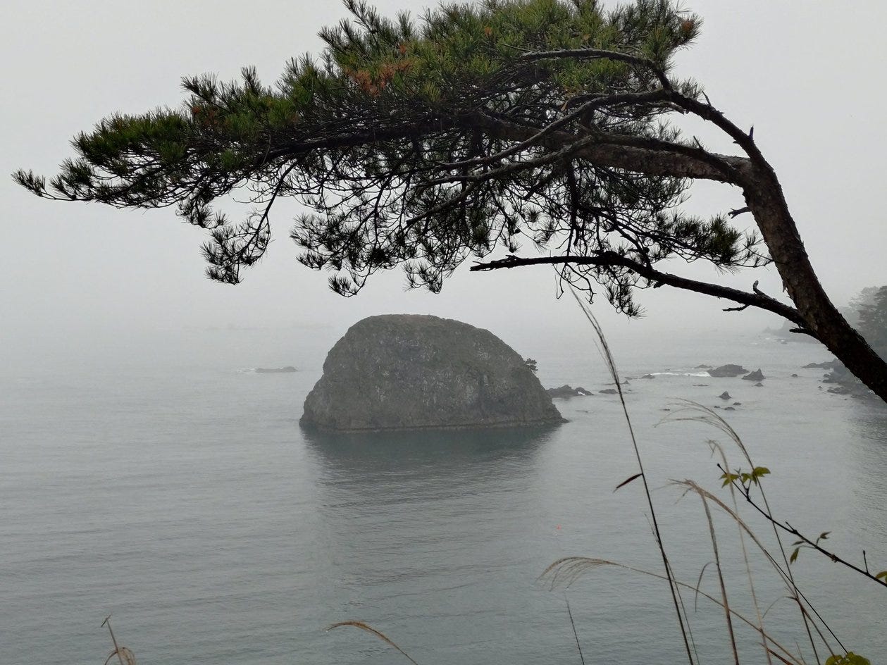
A little further you see this island, which is also filled with seagulls
The route
The peninsular is part of the 1000km Michinoku Coastal Trail. I’d like, some day when I have more time and money, to walk the whole thing because it’s full of spectacular scenery. However since I’m a poor wage slave I was limited to doing just a little bit and the Goishi coast is one of the more spectacular bits.

We started at the visitor center circled at the bottom left on the map. We went down to the cape then back up the RHS all the way to the Anatoshi Iso (top right underline), following the red path except for the last 500m (which were clearly signed). Then we went back onto the red route, which is a road for a while but cut more directly along (more or less) the purple line to join the other part of the red, then walked back to the cape and visitor center.
As I said at the top it’s quite feasible to simply do an out and back on the same coast course. It’s also simple and quicker to cut back on the main road to the visitor center when you get to it.
We went to the other coast because we were curious to see some of the post tsunami sea walls.
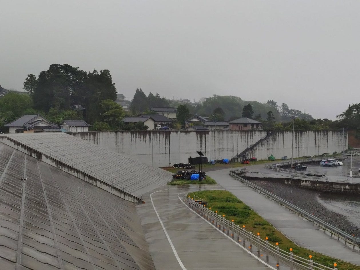
The Tomarisato (泊里) fishing port is one which now has a huge sea wall separating it from the (mostly rebuilt) houses and so we went to it on the way back. There are some obvious steps to climb up to get to the top and it is pretty mindblowing to realize that the tsunami was high enough to just about go over such a wall at Fudai. Fudai was almost entirely protected by its 15m wall, unlike places without such defenses such as Tomarisato (and all the other ports in the vicinity)2.
For fun just after the port we came across a cake vending machine.
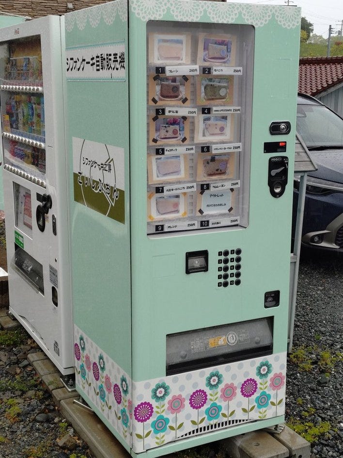
Since at this point the sky was urinating rain excessively we didn’t stop to try one, if you have better weather please do and tell me what it looks/tastes like.
The total distance we hiked was roughly 10km
Kikusuikan Ryokan ( 旅館 菊水館 ) - strongly recommended for the food
This second post covers the Rikuzentakata Memorial Museum which is fascinating if you are interested in the tsunami and the devastation it caused.
Tsunami Impacts

As I mentioned in the previous post, we visited the area that was devastated by the 2011 earthquake and tsunami. We didn’t specifically go to look at the devastation or how things have recovered but it’s an interesting topic and seems suitable for “less known Japan”
Not germane to your well written hike essay Francis, but looking at the cake vending machine I though you might get a kick out of there two; https://soranews24.com/2025/05/16/steampunk-vending-machines-appear-in-japan-and-heres-how-to-find-them/
Those first photos remind me very much of some parts of the Olympic Peninsula in Washington State. It is also very atmospheric, and often socked in.